Our Motivation
In the Central Valley lab, one of our main missions is to make information on groundwater contamination due to concentrated animal feeding operations (CAFOs) publicly accessible. CAFOs are one the largest pollutants of groundwater and air as they widely generate, store, and apply large amounts of liquid manure–mostly in the form of waste lagoons.
Currently, there are no existing comprehensive datasets that identify all CAFO locations throughout the Central Valley. Without this knowledge, it is difficult to gauge their true impacts on surrounding areas and examine how existing vulnerabilities experienced by DACs may be exacerbated through CAFO related water contamination.
The development of a CAFO layer will contribute to important work on ongoing questions such as the extent of CAFOs’ relation to groundwater pollution, the spread of contaminants through the basins’ aquifers, air quality health, and related human health concerns. This project will result in publicly accessible GIS shapefile layers of CAFOs that can be used for analysis and support policymakers and environmental advocates working on this issue.
Our Approach
Using high-resolution satellite imagery and geospatial tools available in ArcGIS Pro, the locations of CAFOs are identified, marked, and analyzed in relation to each other, important water features (major rivers, agriculture canals, etc.), and groundwater and land surface elevation gradients. By leveraging publicly available high-resolution satellite data (MAXAR) within GIS, the CV is split by counties and manually examined for CAFOs through 1 km2 grids. Dairy CAFOs are identifiable by their multiple, mostly parallel buildings, often visible animals, and the presence of waste storage and/or lagoons. Beef cattle CAFOs are distinguishable by their fewer buildings and square dirt enclosures. To locate CAFO sites, we consulted Google Maps and Google Earth to search for streetside signage. We utilized local county and township websites to cross-reference and ascertain property boundaries and site names. Once identified, sites are then marked with analysis tools and cross-checked for names, type of feeding operation, number of animal heads, present waste lagoons, and groundwater basin.

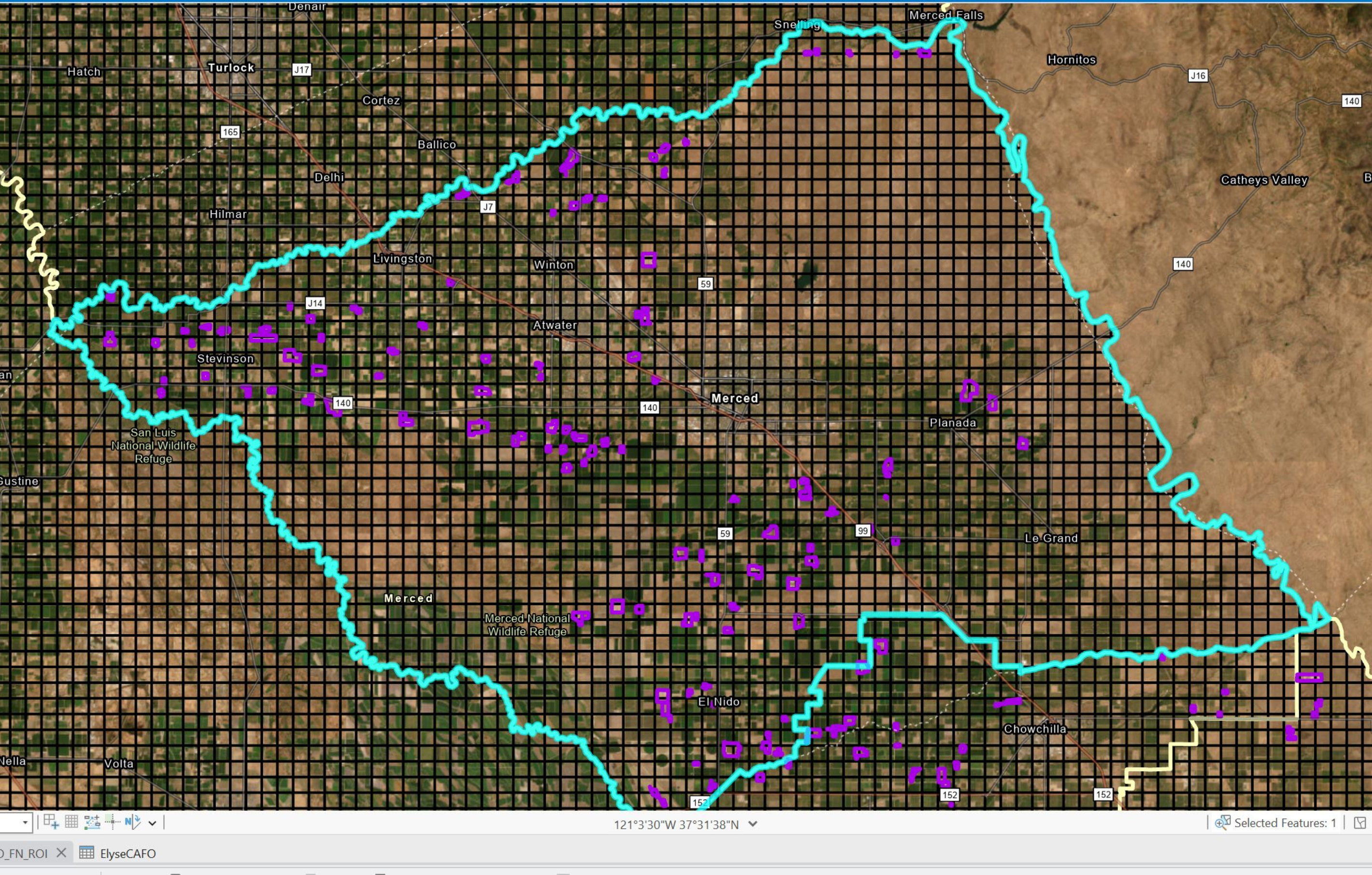
The team goes through a grid of 10 km2 using satellite imagery to locate and identify dairies, poultry farms, and ranches in the CV. The Merced basin holds many CAFOs, mostly in highly concentrated areas like the northwest corner and southwest corner, which often overlap with the Chowchilla basin.
Figure by Elyse Kenyon, Stephanie Davis, and Jake Dialesandro.

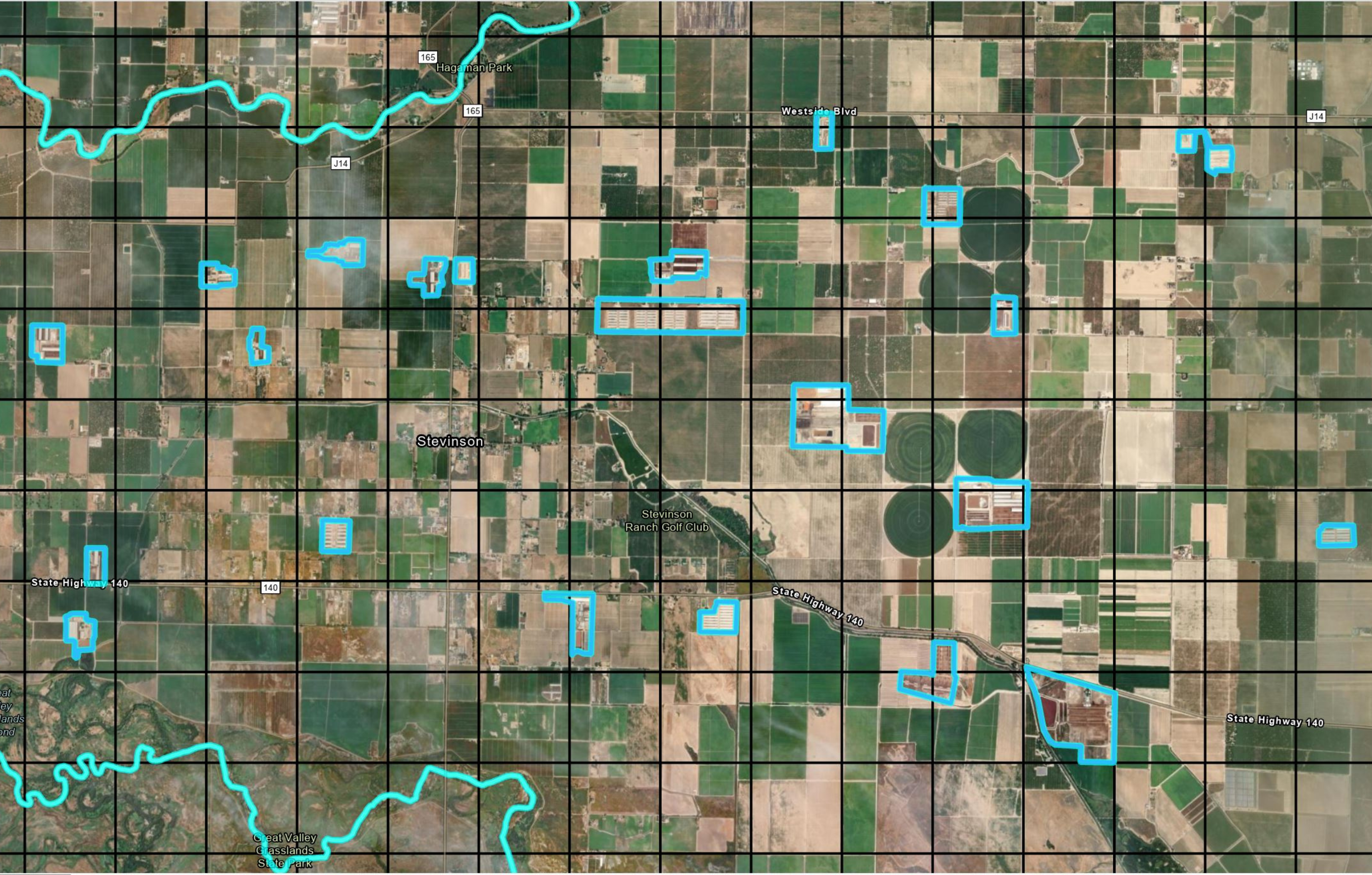
Utilizing the Create tool, the team locates and digitizes the CAFOs throughout the CV. This image showcases what the CAFOs look like from above and what an area of the valley looks like once it has been thoroughly combed through.
Figure by Elyse Kenyon, Stephanie Davis, and Jake Dialesandro.

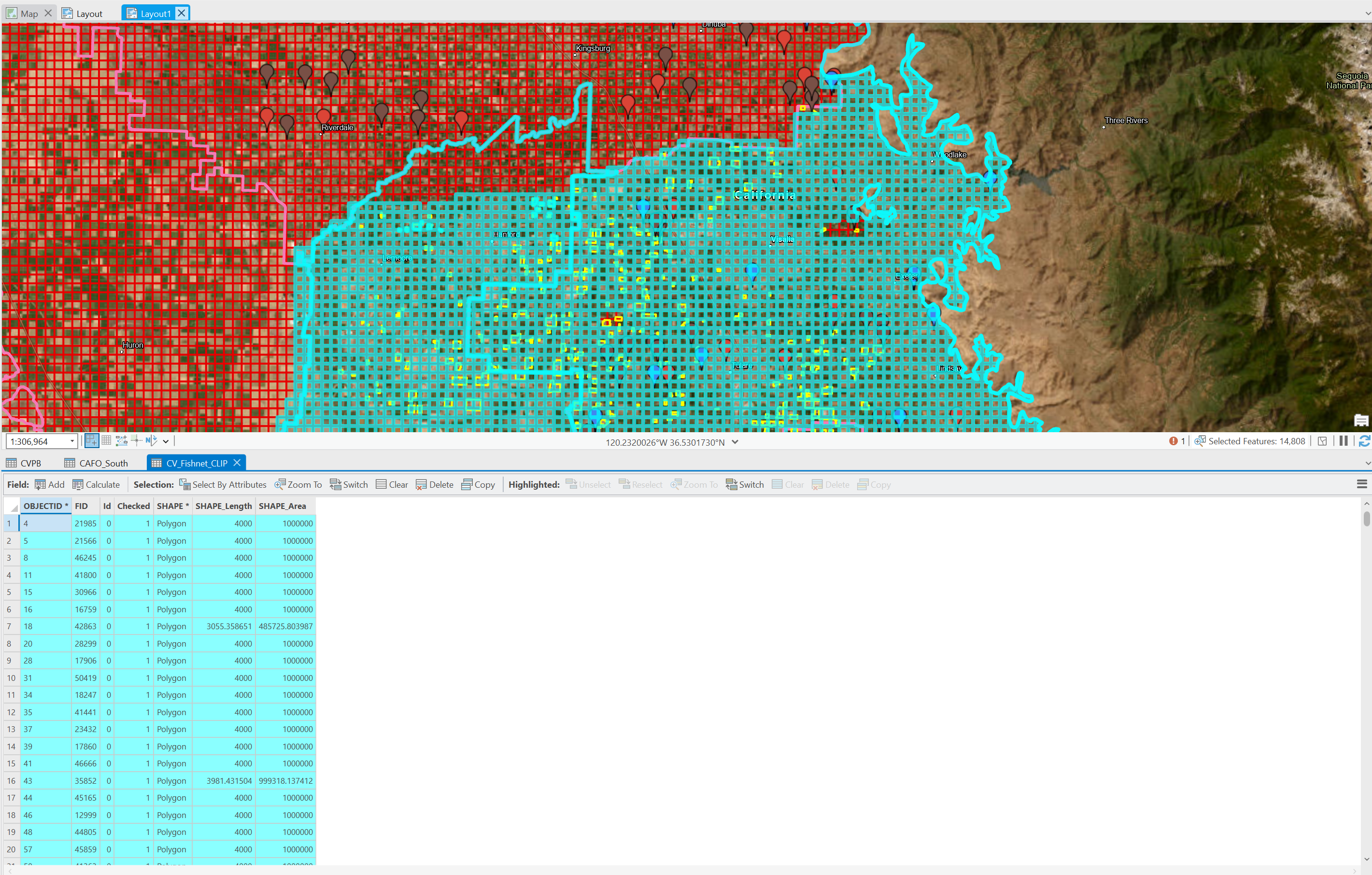
Utilizing ~10 km2 grid boxes, following a thorough inspection of target areas, corresponding boxes are selected and delineated as checked using a 1 in the data table. This image showcases this method and the distinct color contrast between checked regions(marked in blue) and unchecked regions(red).
Figure by Stephanie Davis, Elyse Kenyon, Jake Dialesandro, and Iris Stewart-Frey.

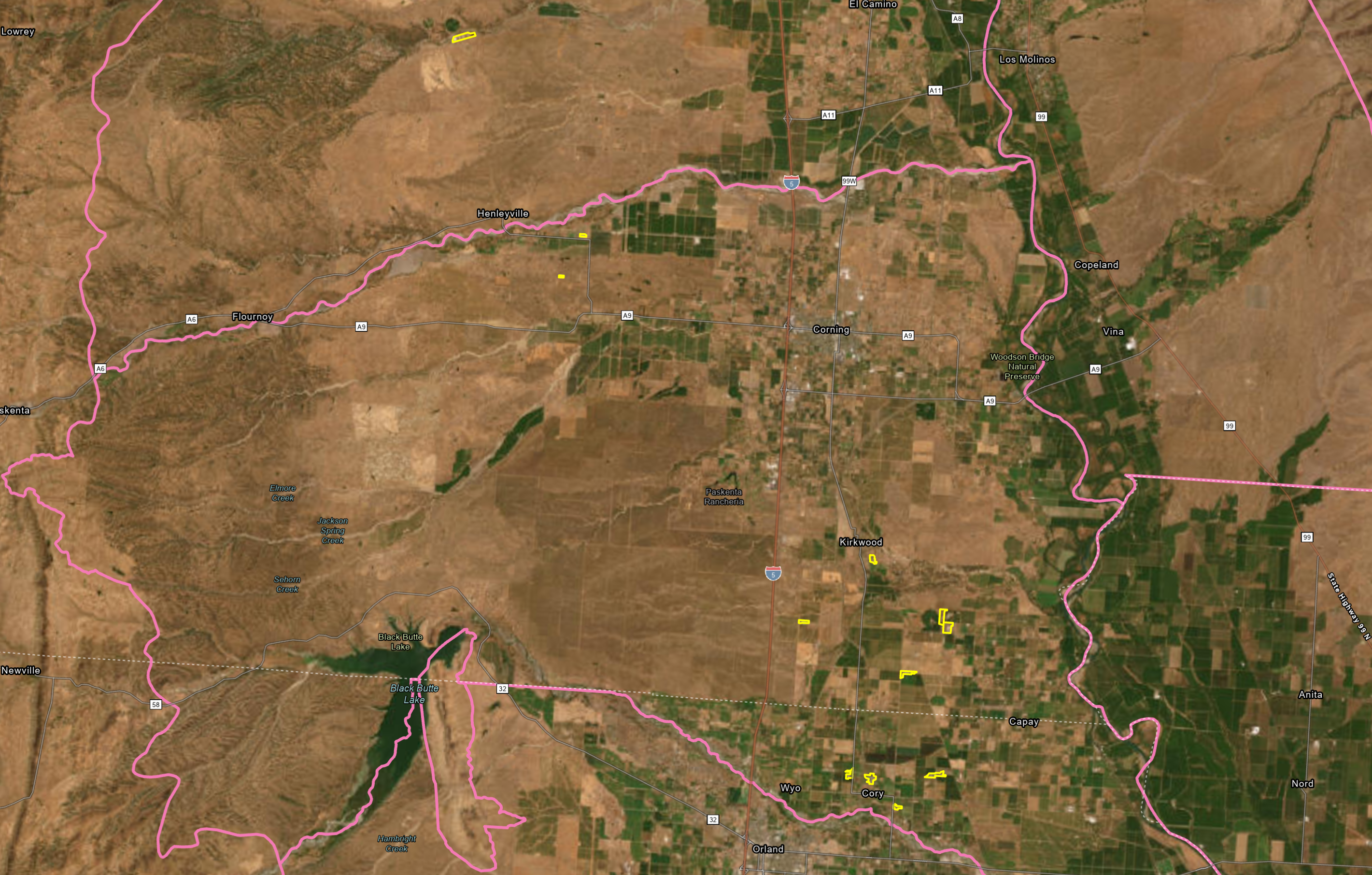
Oftentimes, areas with a higher percentage of mountainous landscapes resulted in a significant decrease in CAFOs identified. This image shows the comparatively sparse concentration of CAFOs (outlined in yellow) found in the lower Red Bluff and Corning Basins in the Sacramento Valley region of Northern California.
Figure by Stephanie Davis, Elyse Kenyon, and Jake Dialesandro.
Our Results
Data on CAFO locations and identities is currently unavailable as a public map layer. This information is particularly important because it allows large industries to be held responsible for their environmental impacts. The generated GIS CAFO will allow the public to know where the CAFOs are, and also the level of density of CAFOs in a focus area. This will aid in understanding CAFO density in the Central Valley and the consequences of this subsidized sector.
Currently, we’ve found well over 1000 CAFOs at this stage and have successfully identified over half of them.
While identifying, we found large disparities in where they are located within the CV. CAFOs are typically found in groupings, concentrated in small areas. This could have significant impacts on groundwater and air quality health. Outside of these high density areas, CAFOs are less common and singular. More CAFOs are found away from cities in open areas of the valley. Some basins with high levels of concentrated CAFOs are Kings, Tulare/Tule, Merced, and Kaweah.


